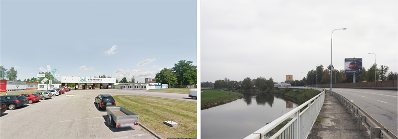
The history of the exhibition center in České Budějovice starts back in the 1960s. Since 1970 Země živitelka, one of the largest and most important agricultural exhibitions in the Czech Republic, has been held here regularly. Today, unfortunately, most of the exhibition buildings are in a very poor technical condition and they no longer meet current requirements. A complete reconstruction is inevitable
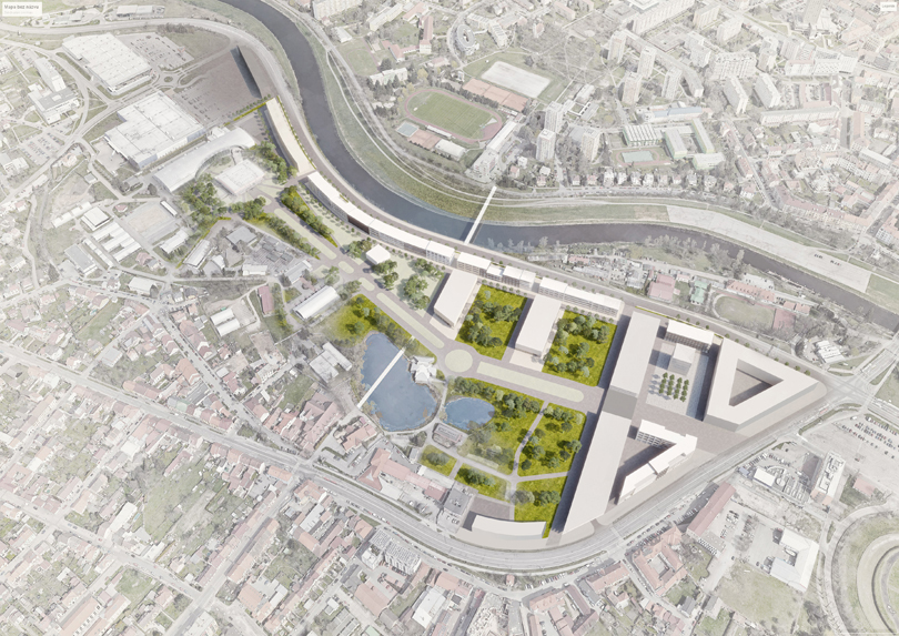
Proposed modifications are based on the Urban Study of the area (ÚS „Výstaviště – sever“ and ÚS „Výstaviště – jih“, author: Brůha a Krampera, architekti, spol. s.r.o., 2017), which defines the main strategic goals as: “transformation of the exhibition grounds into a business, administration and presentation center, which is part of the inner city, surrounded by greenery and open to the Vltava river; the future transformation of the left-bank road from a transport corridor to a city street; creation of a footbridge over the river and opening of the whole area to the inhabitants of the city.” Our urban design of the exhibition grounds respects the height limits and the ratio of built-up and undeveloped areas defined by the Urban study.
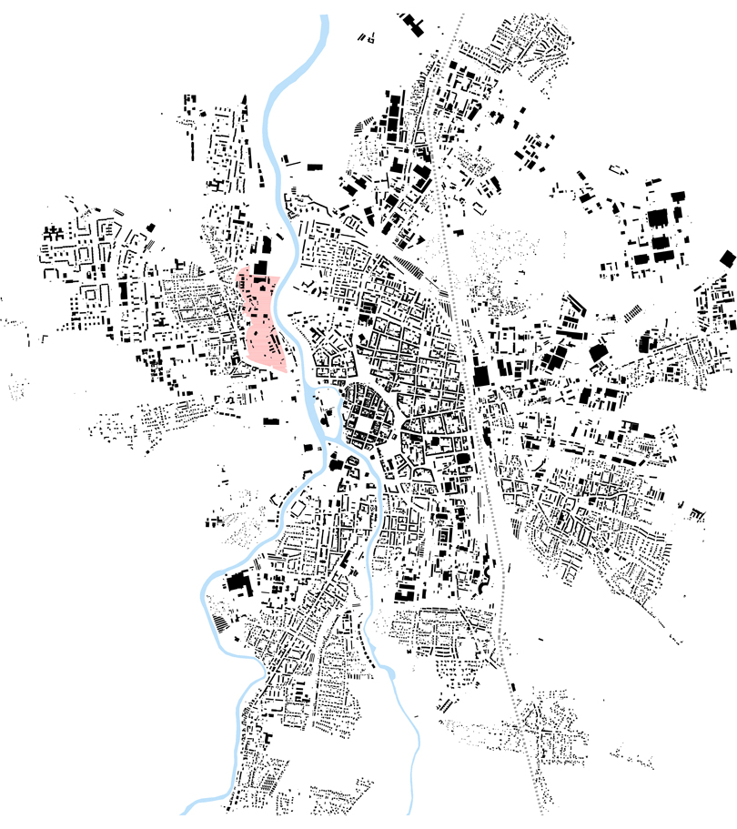
The uniqueness of the České Budějovice exhibition center is based mainly on its park character and on its proximity to the historic city center. The main problem of the exhibition center is its introversion towards the city, which is even emphasized by the proximity towards the historic center. The whole complex creates a giant barrier and considerably complicates movement between individual city districts. The opening of the area to the city and its inhabitants and creating more attractive environment should guarantee the enlivening of the space throughout the whole year, also between the exhibitions. However, the degree of openness must fully respect the long tradition of organizing exhibitions, during which the variable possibility of closing the exhibition grounds, or part of it, is necessary.
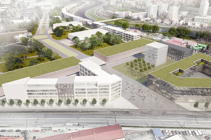
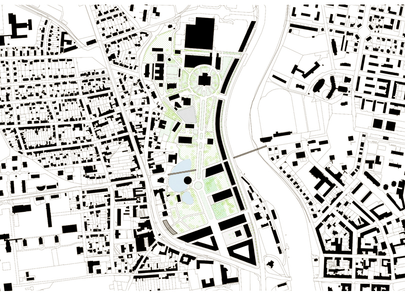
We divide the area of about 25 ha into three zones. The first is the area in front of the entrance to the whole exhibition centre, which is the defined by the intersection of Na Dlouhé louce and Husova streets and by the southern entrance gate. The other two zones, left and right, are part of the interior of the exhibition center and are separated by the existing axis of the main pedestrian road.
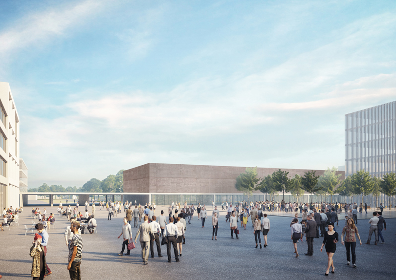
The first zone is currently in a very vague state, it is a large empty place, but also a busy intersection of important roads. We define a new square here closed on four sides by new buildings, two blocks, a solitary building adjoining Na Dlouhé louce street and the entrance gate itself. The functional use of the newly designed buildings will be of a mixed character – civic amenities, administration, exhibitions, etc., the block closest to the intersection can be used, for example, for a long-term planned science center. In the middle of the square, we design an elevated solitary building, an exceptional architecture with a different function, such as the Museum of Agriculture. The entrance gate, a generous roof covered space, is wedged between two parking houses, whose ground floor serves for commercial purposes (reception, shops, restaurants, etc.).
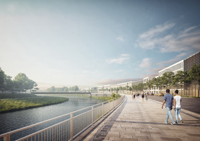
In the right zone of the complex, we design three new exhibition pavilions, oriented perpendicular to the main communication axis of the exhibition center. This orientation predetermines the scale-friendly rhythm of outdoor and indoor exhibition areas. The pavilions do not form the boundary of the exhibition grounds, because of the future plan to transform the busy Dlouhá louka traffic road into a city street. New line of buildings with living commercial parterre is planned instead of the existing fence, which should help the transformation of the Dlouhá louka street.
The left zone of the exhibition center will preserve to a maximum extent its park character. The existing exhibition pavilions of a rather small scale will play an important role here together with the greenery and water areas. Their sensitive reconstruction will point to the time of their creation and they will become an important legacy enriching the environment with one significant historical trace.
The urban study and the masterplan of České Budějovice defines the construction of a new footbridge connecting Jiráskovo nábřeží with the opposite bank to create the pedestrian and bicycle connection of the city center with the district Čtyři dvory. The original intention to create one footbridge above the exhibition grounds does not seem ideal, when we consider the investments costs. But mainly it does not correspond with the aim to open the exhibition area to the inhabitants. We propose two footbridges at the ground level, one across the Vltava River and the other across the existing pond.